Enter your search terms:
Top
 

Insured

We are fully insured under a UAV industry specific insurance policy with a coverage of up to $6,250,000 liability.

Certified

We operate under a Standing SFOC permit allowing nighttime, daytime and controlled airspace operation.

Trained Pilots

Our pilots are UAV ground school graduates and are required to undergo rigorous internal safety training.

Orthophoto

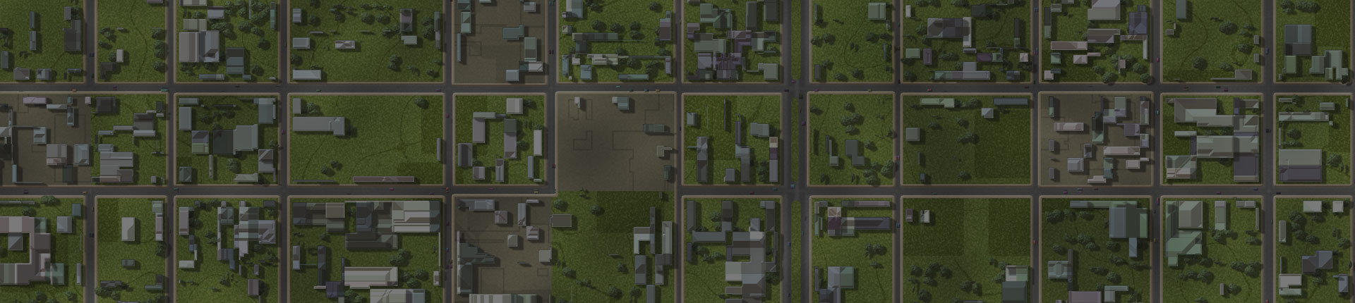
SkySnap specializes in orthophotography, the creation of orthomosaics. Our aerial mapping Toronto company’s Orthomosaics are digitally corrected and remapped aerial photographs that are assembled into one high-quality map. We can provide virtually any level of detail, which is dependent on the flight altitude.

Georeferencing

We offer a highly-accurate georeferencing aerial mapping service in Ontario as well as all regions of Canada. SkySnap utilizes two primary approaches to georeferencing, the manual approach, which includes in-field coordinate recording or referencing done at our Toronto aerial mapping office to an existing map.

More Info

3D Mapping

Our company produces extremely accurate models of landscapes and structures utilizing 3D point-cloud and mesh models. Our drone 3D mapping analysis is done at our Toronto office; however, we offer services across Canada. Our 3D aerial mapping service in Canada is used for surveying, construction and 3D modelling.

More Info

Thermal Mapping

In addition to 2D and 3D aerial mapping, SkySnap uses thermal camera equipped drones for thermal mapping applications. We can apply georeferencing techniques to thermal maps and create either stand alone thermal maps or orthomosaics that combine both conventional photographs and thermal images.

Volume Analysis

We are able to use the data collected in our initial analysis to perform volume calculations. We use a suit of software applications that enable us to take relatively precise calculations. Our drone aerial mapping service has numerous applications outside of pure mapping, we have a full range of analytical options.

Elevation & Surface Modeling

Our aerial mapping service can also be utilized for Digital Elevation Modeling (DEM) and Digital Surface Modeling (DSM). We are not limited to DEM and DSM models, we can perform a wide range of surface and infrastructure models. This type of modeling is performed through geospatial mapping from 2D aerial images.

Lets Talk About Your Project